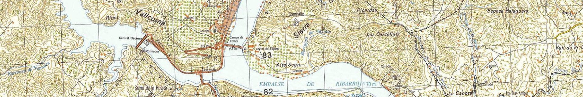
The exploitation has been located on the ENTSO-E map. The location coordinates of various components of the power plant correspond to the following UTM coordinates that are related to the zones indicated below.
- – upper reservoir limits: they correspond to the four vertices of the intersection of the four straight base sides of the perimeter dam:
| COORDINATES OF THE UPPER RESERVOIR VERTICES. | ||||
| vertex | ED50 system / zone 30 | ETRS89 system / zone 31 | ||
| X | Y | X | Y | |
| 1 | 774.699 | 4.587.582 | 272.946 | 4.585.723 |
| 2 | 773.505 | 4.590.931 | 271.986 | 4.589.147 |
| 3 | 774.835 | 4.590.951 | 273.315 | 4.589.074 |
| 4 | 775.835 | 4.588.146 | 274.119 | 4.586.207 |
- – endpoint of the segment that corresponds to the pipeline axis of the upper reservoir / turbine :
| WELL AXIS COORDINATE IN THE UPPER RESERVOIR | ||||
| endpoints
of the axis |
ED50 system / zone 30 | ETRS89 system / zone 31 | ||
| X | Y | X | Y | |
| 1 | 775.313 | 4.588.041 | 273.591 | 4.586.139 |
| 2 | 775.518 | 4.588.475 | 273.825 | 4.586.558 |
– endpoint of the segment that corresponds to the axis of the lower intake in the Segre river according to the alignment with the N-211 road. The coordinates belong to the points of the intersection between the road axis and the endpoints of the catchment area works:
|
HEADWORKS AXIS COORDINATE IN THE LOWER RESERVOIR |
||||
| endpoints
of the axis |
ED50 system / zone 30 | ETRS89 system / zone 31 | ||
| X | Y | X | Y | |
| 1 | 777.308 | 4.587.603 | 275.551 | 4.585.564 |
| 2 | 777.031 | 4.587.220 | 275.248 | 4.585.200 |
LOCATION OF THE REVERSIBLE PUMPED STORAGE HYDROELECTRIC PLANT ON THE SEGRE RIVER (TOWNSHIP OF MEQUINENZA-ZARAGOZA-SPAIN)” IN THE ENTSO-E MAP

